TERENO
Cadaster Module
TERENO Cadaster module is the digital backbone of modern land administration. A system where maps, ownership records, and legal documents come together to tell the story of every piece of land.
About This Module
TERENO Cadaster module is the digital backbone of modern land administration. A system where maps, ownership records, and legal documents come together to tell the story of every piece of land. At its core, it transforms the centuries-old practice of land registration into a living, interactive map of a nation’s territory.
Imagine opening a detailed map where every parcel of land every field, plot, or building site is more than just a shape on the screen. With a few clicks, you can see who owns it, how large it is, what it’s worth, and what it’s used for. You can trace its history through past owners, see where its boundaries have changed, or verify the survey data behind its coordinates. That’s what a cadaster software makes possible: it bridges geography and law in a single, precise system.
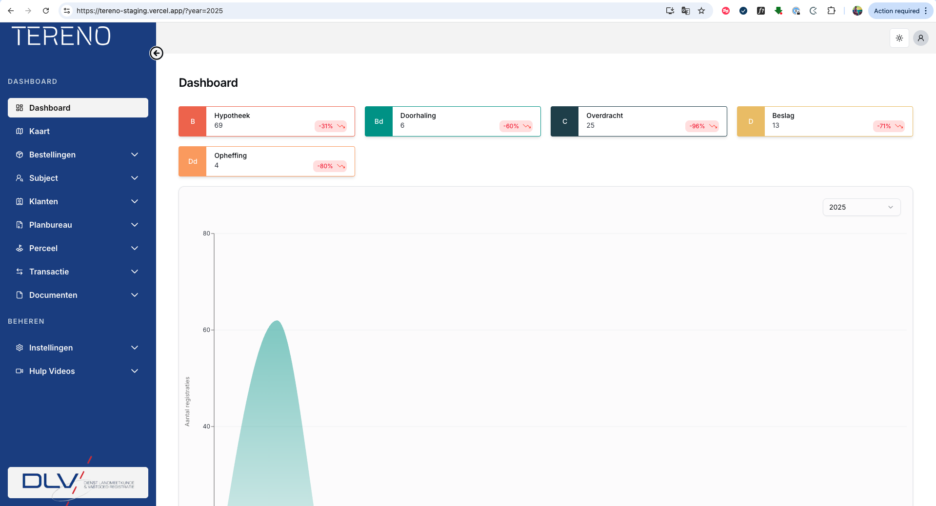
Behind the scenes, it integrates advanced GIS (Geographic Information System) technology with legal and administrative databases, linking spatial information with ownership records and land titles. This integration allows surveyors to update parcel boundaries in real time, government officials to process transactions with accuracy, and planners to analyze how land is used across cities and rural regions.
For citizens, the system brings clarity and trust — disputes over land can be resolved with clear evidence, and property transactions become faster and more transparent. For governments, it becomes a tool of accountability and planning: tax assessments, infrastructure development, and environmental management all rely on the consistent, verifiable data a cadaster provides.
In short, TERENO Cadaster module is much more than a digital map. It is the living record of how people relate to land who owns it, how it changes, and how it shapes the growth of communities. By combining precision mapping, legal documentation, and administrative control, it becomes a foundation for fair governance, sustainable development, and economic progress.
By combining precision mapping, legal documentation, and administrative control, TERENO Cadaster becomes a foundation for fair governance, sustainable development, and economic progress.
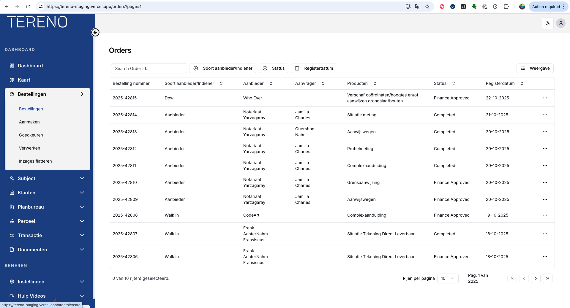
- Integrated GIS and spatial data management
- Real-time status tracking and notifications
- Secure role-based access control
- Full audit trail and compliance logging
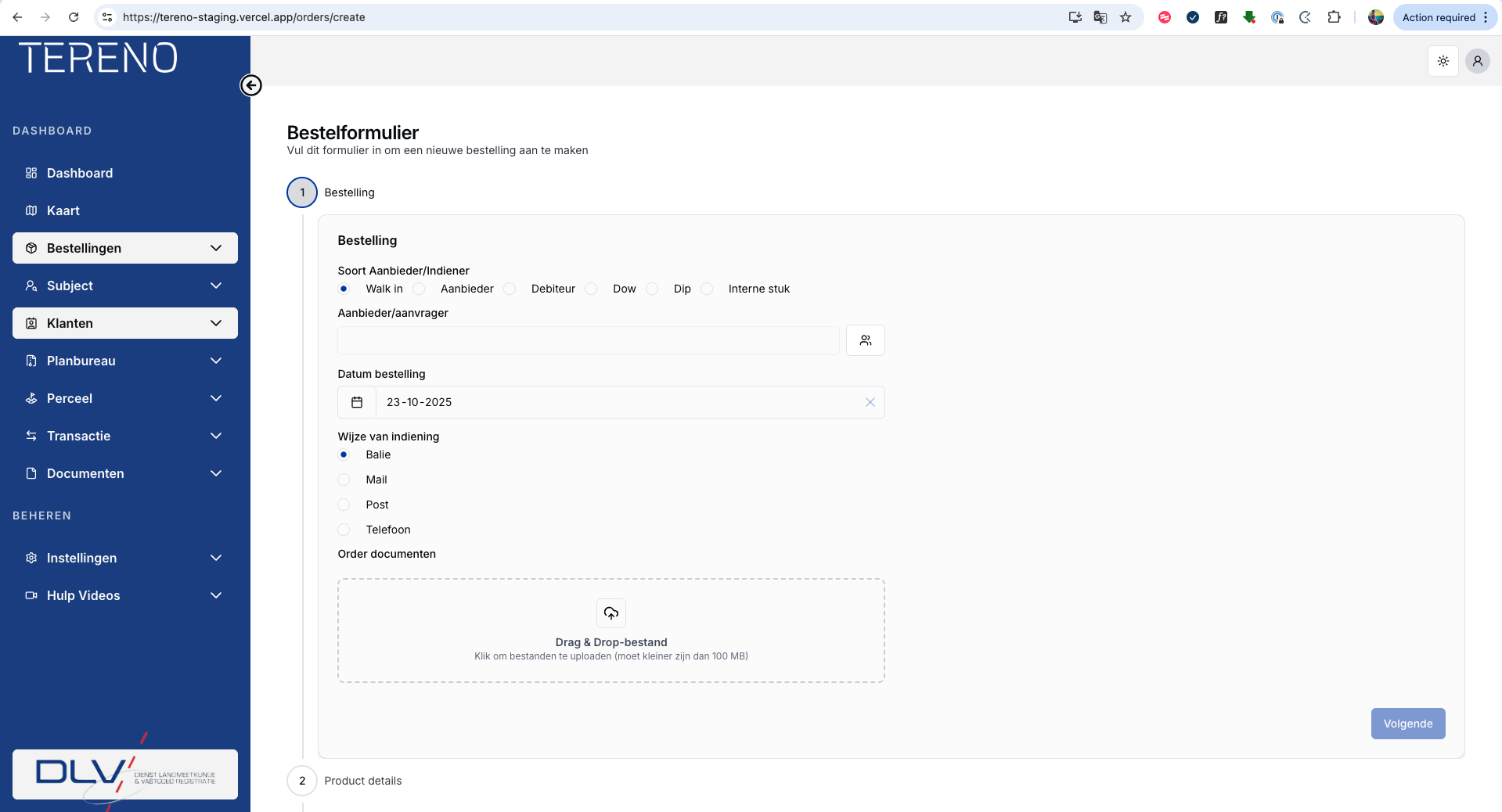
- Digital workflow and automated routing
- Online payments and document download
Ready to Get Started
with TERENO Cadaster Module?
Talk to the DataAxis team about implementing this module for your land administration authority.
Contact DataAxis